David Noel
<davidn@aoi.com.au>
Ben Franklin Centre for Theoretical Research
PO Box 27, Subiaco, WA 6008, Australia.
SC008: The Lismore Channel: towards flood control in Lismore, New South Wales
Why does Lismore flood?
The City of Lismore, in New South Wales, Australia, is notorious for its liability to flooding. Even a 10.65-metre high concrete wall flood levee, finished in March 2005, has been insufficient for protection.
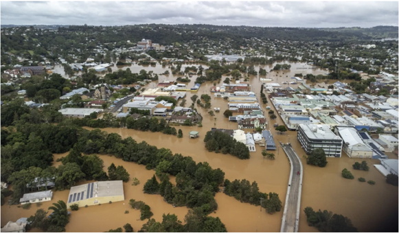
SC008-F1. Flooding in Lismore. From [2].
Figure F1, a photo taken March 1, 2022, shows the levee completely underwater. The levee goes along the river on the CBD side. Wilsons River is in the foreground, Bridge Street is underwater on each end of the bridge, Browns Creek pumping station is almost submerged just below the centre of this image.
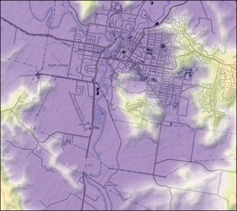
The topography of the Lismore district (Figure F2) shows why Lismore is so liable to flooding. Higher lands, to the west, north, and east, all combine in a single large watershed to direct rainfall to a common point just by Lismore City.
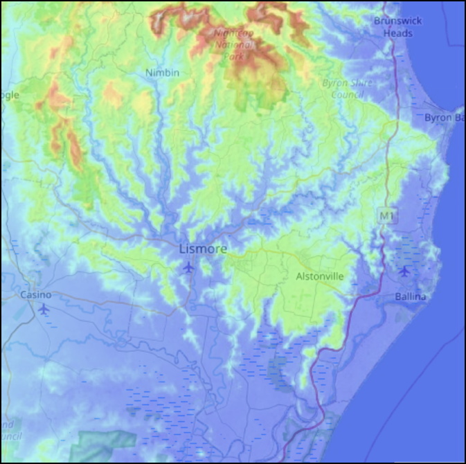
SC008-F2. Topography of the Lismore area. From [4].
Different parts of this large watershed will each receive large variations in rainfall at somewhat random times. When, by chance, all areas receive heavy rainfall at the same time, or some areas receive exceptionally heavy rainfall, this can be enough to raise the river flow to flood levels.
The local response to flooding, up to 2022, has been one of effectively raising a river bank by building a concrete flood wall or levee. There is another approach possible, that is, by effectively lowering the river. This has been successful elsewhere.
Flooding in Los Angeles
Europeans founded what was to become the City of Los Angeles in 1781 [3], along the banks of the Los Angeles River, which was the primary water source for the growing city until 1900. Over time, people built homes closer and closer to the river's banks -- dangerously close, because the L.A. River can grow from a trickle to a raging torrent in just a few hours.
And that's exactly what it did in February 1938, after it rained more in a single day than it normally did in a year. The river surged beyond its banks. It took out bridges. It took out houses. It flooded Echo Park and Venice and surrounded Warner Brothers Studios like a moat [3].
Afterwards, the US Army Corps of Engineers began encasing the river in a deep concrete channel that would keep it from spilling out of its banks during future floods. They erected fences and put up "No Trespassing signs." It took 20 years and 3.5 million barrels of cement [3].
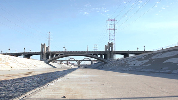
SC008-F3. Drainage channel on the Los Angeles River. From [6].
Many people today will be familiar with this concrete channel, because it was the site of the car-racing scenes in the John Travolta & Olivia Newton-John movie "Grease".
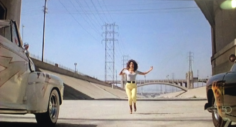
SC008-F4. Scene from movie "Grease". From [1].
Reforming Lismore waters to avoid flooding
Here are some preliminary proposals for works to alleviate Lismore's flood problems. Considerable surveying and test works may be needed before arriving at a final Plan of Action.
SC008-F5. Lismore waters at present.
Figure F5 shows the layout of Lismore and its environs as of 2022. It can be seen that the principal sources of water coming into Lismore are firstly Leycester Creek, from the West-Northwest, and Wilsons River, coming in from the East-Northeast.
Phase 1. It is suggested that a plan be implemented in two phases. The first would be Phase 1. This might be sufficient on its own to achieve satisfactory flood control for Lismore.
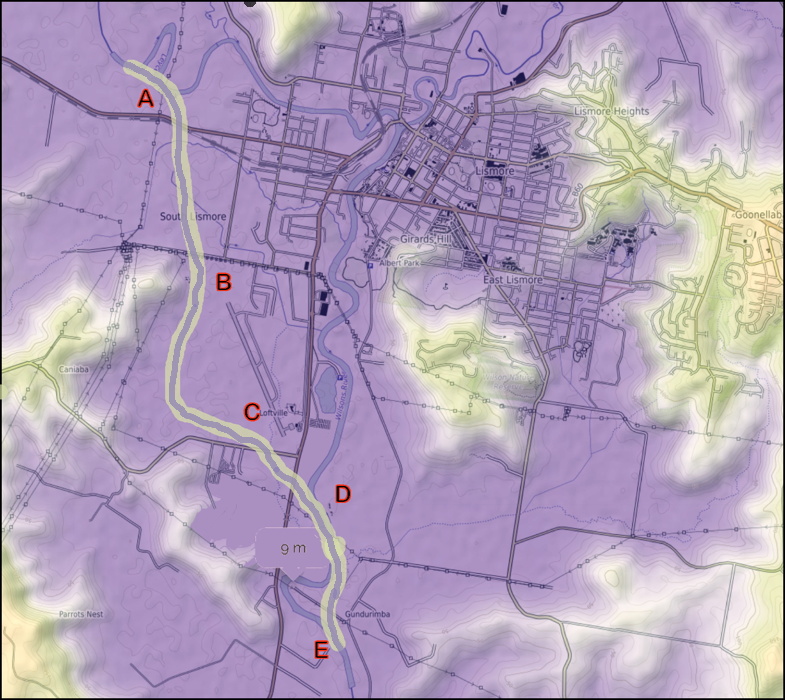
SC008-F6. Phase 1 of works.
The intention is to cut into the ground along the route shown by the letters A-B-C-D-E to create a new channel with a double profile.
The deepest cut would be for the water flowing in from Leycester Creek. This might be, say, 3 metres deep, and obviously at sufficient gradients for water gathered at A to flow under its own head to E. This cut is shown in blue-grey along the centre of the light-yellow strip A-B-C-D-E. The centre cut should be calculated deep enough to contain water flows at normal levels.
The light-yellow strip is intended to represent land, on the shoulders of the main cut, which could be inundated in time of flood without causing damage to buildings or installations -- land which could be kept as parkland.
It may be that Phase 1 would eliminate enough water from approaching the city site, even in times of flood, that no further control would be needed. If not, then Phase 2 could be undertaken.
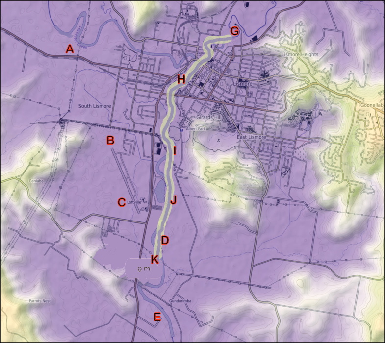
SC008-F7. Phase 2 of works.
With both Phases in operation, the water-flow plan would be as indicated in Figure F8.
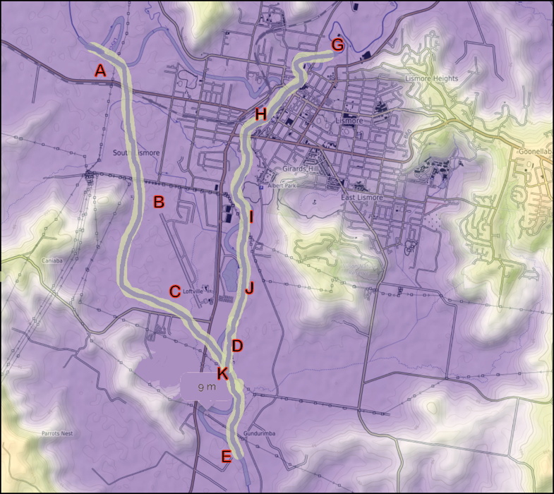
SC008-F8. Both phases of works.
Further thoughts
Implementation of the suggested plan would obviously involve costs for considerable amounts of earthmoving. But done sensibly, it could release considerable amounts of land along the former junction of Leycester Creek, land which should be suitable for housing, commerce, or public use..
References and Links
[1]. Grease. Movie, Paramount, 1978.
[2]. Eve Jeffery. A new levee and river remodelling for Lismore?. https://www.echo.net.au/2022/03/a-new-levee-and-river-remodelling-for-lismore/ .
[3]. Emily Guerin. LA Explained: The Los Angeles River. https://laist.com/news/climate-environment/los-angeles-river-explained/ .
[4]. Lismore City Council. https://en-au.topographic-map.com/maps/j8cu/Lismore-City-Council/ .
[5]. Mapworld. https://www.mapworld.com.au/products/lismore-9540-2n-topographic-map-1-25k .
[6]. L.A River Bridges, Los Angeles. https://videohive.net/item/la-river-bridges-los-angeles/13671044 .
* * * * * * * * * * * * * * * * * *

Go to the Social Engineering Home Page

Assembly begun 2022 Apr 19.
Version 1.0, on Web 2022 Apr 22.
